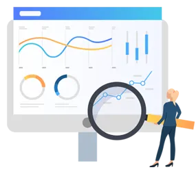
Spatial data analysis is the process of examining and interpreting data that has a geographic or spatial component. It involves using specialized techniques and tools to analyze and visualize data associated with specific geographic locations or regions. Spatial data analysis is commonly used in fields such as geography, environmental science, urban planning, and epidemiology. It helps researchers and analysts uncover patterns, relationships, and trends in data that are influenced by geographic factors, such as proximity, location, and spatial distribution. Geographic Information System (GIS) software is often used in spatial data analysis.
Spatial data analysis is used in various industries to gain insights and make informed decisions based on geographic and location-based information. The major industries that use spatial data and analytics are as follows:
- Retail & Marketing: Retailers analyze spatial data to determine the best locations for stores, understand customer demographics, and optimize supply chain logistics. Spatial data can help retailers better understand their customers and improve their shopping experience.
- Agriculture: Precision agriculture relies on spatial data analysis to optimize crop planting, irrigation, and fertilizer application based on soil conditions and weather patterns.
- Healthcare: Healthcare providers use spatial data to analyze disease outbreaks, plan the locations of healthcare facilities, and assess the accessibility of medical services.
- Transportation & Logistics: In the transportation industry, spatial data analytics can be used to optimize routes, track vehicle locations, and identify areas of congestion. Spatial data can help transportation companies save time and money while improving the customer experience. It helps in route planning, fleet management, and the optimization of delivery schedules, which is crucial for transportation & logistics companies.
- Telecommunications: Telecom companies use spatial analysis to plan network coverage, optimize cell tower locations, and improve service quality.
- Energy: The energy sector uses spatial data to plan and optimize the placement of power plants, wind farms, and solar installations.
Various industries and organizations are discovering new ways to leverage spatial data analysis and geospatial intelligence. With the growing use of spatial data and analytics, several location-based solutions providers are launching advanced solutions for various industries. For instance, in December 2023, Ocient Inc. (U.S.), a leading hyperscale data analytics platform, launched OcientGeo, a suite of spatial database features for enhanced spatiotemporal query performance and analytics at scale. OcientGeo provides high-resolution analysis, the industry’s largest library of geospatial functions, and a spatial index optimized for objects on land, air, and water for use cases across government, automotive, telecom, and emerging sectors that leverage geospatial data. Such developments and the increasing use of spatial data and analytics across industries are driving the growth of the location-based services market.
Access Full Report Here @ https://www.meticulousresearch.com/product/location-based-services-market-5252
Related Tag:
Related Blogs:

Rising Need for Home Safety & Security
Read More
Zero Trust Networking
Read More
Factors Affecting Speech and Voice Recognition Market Growth
Read More
Growing Adoption of Cloud Infrastructure in the BFSI Sector
Read More
Data Protection Regulations Boosting the Adoption of Digital Vaults
Read More
Growing Demand for Chemical Surface Treatment Solutions
Read More
Growing Need for Cybersecurity Services Among SME's
Read More
Benefits of Cloud-Based Industrial Asset Management Solutions
Read More
Increasing Importance of English Language to Drive Market Growth
Read More
Video Analytics for Enhanced Surveillance
Read More
Mobile Computers for Efficient Data Collection
Read More
AI-based Cybersecurity Solutions in the BFSI Sector
Read More
RFID Technology among Manufacturing Industries
Read More
Development of Smart Infrastructure
Read More
Growing Security Requirements in the BFSI Sector
Read More


